Storage Basket
Item number Nd603 from the MOA: University of British Columbia.
Item number Nd603 from the MOA: University of British Columbia.
This page shows all the information we have about this item. Both the institution that physically holds this item, and RRN members have contributed the knowledge on this page. You’re looking at the item record provided by the holding institution. If you scroll further down the page, you’ll see the information from RRN members, and can share your own knowledge too.
The RRN processes the information it receives from each institution to make it more readable and easier to search. If you’re doing in-depth research on this item, be sure to take a look at the Data Source tab to see the information exactly as it was provided by the institution.
These records are easy to share because each has a unique web address. You can copy and paste the location from your browser’s address bar into an email, word document, or chat message to share this item with others.
This information was automatically generated from data provided by MOA: University of British Columbia. It has been standardized to aid in finding and grouping information within the RRN. Accuracy and meaning should be verified from the Data Source tab.
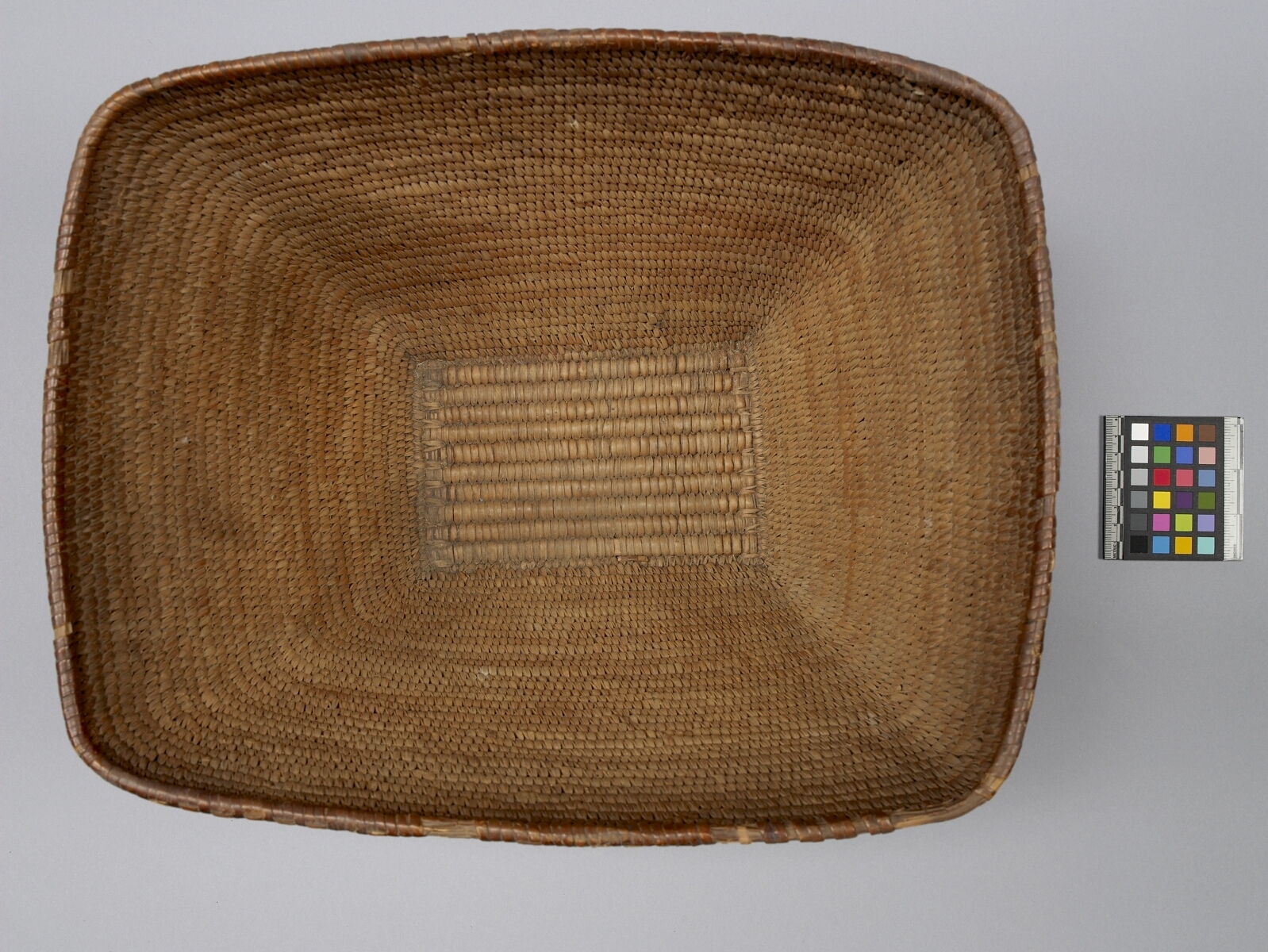
Rectangular cedar basket, flared, decreasing in size to the bottom. Tightly coiled with a slat bottom and a rim of narrow width bundles around which cedar is not coiled. Coiled cherry bark with row of beaded grass finishes top edge. Imbricated design of three horizontal zig zag rows of red and black cherry bark and yellow grass are along the sides.
May have been a cooking basket, as it is tightly coiled, waterproof type. Boiling in watertight baskets was done by filling the basket with water and dropping heated stones into it. Food was placed in the boiling water.
cooking; storage
Basket traded in area between Nanaimo and Jervis Inlet (collector's notes). There are only a few islands in this area to which this information may refer. They are: Thormanby islands, Lasqueti Island, Texada Island, Nelson Island and Hardy Island. A map showing village sites of the Northern Coast Salish in the Handbook of North American Indians, shows that the smaller Thormanby island had a village site that was known as sxwelap 'deep furrow'. Village sites are not indicated for the other islands previously mentioned (see Kennedy and Bouchard 1990:442-3).
Let the RRN community answer your questions
With an account, you can ask other users a question about this item. Request an Account
Share your knowlege of this item with the RRN community
With an account, you can submit information about this item and have it visible to all users and institutions on the RRN. Request an Account


 RRN ID